10 places every Microsoft Flight Simulator player should visit first
Get away from it all.
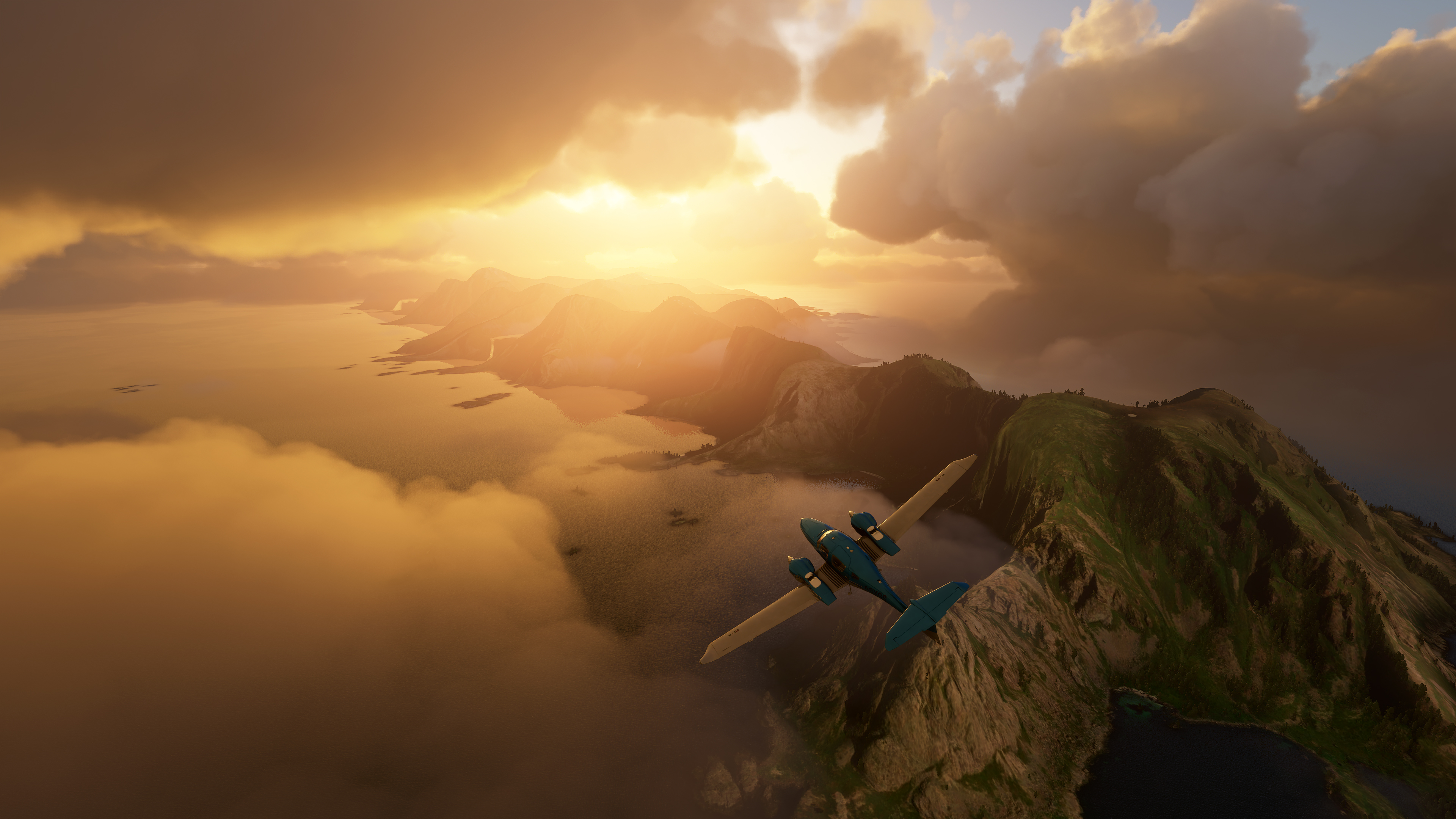
If you've ever spun a globe around, stopped it with your finger, and dreamed about going wherever your digit happened to land, Microsoft Flight Simulator is like that in game form—but here you can actually (well, virtually) go there. Whether it's a famous landmark or your local supermarket, it's in there.
However, with so many places to choose from, where do you even start? I've been playing the game pretty solidly for a month and I've probably covered about 1% of the planet. As far as game worlds go, this is about as massive and daunting as it gets. But here are a few suggestions for places to fly.
If you want a closer look at the maps, you can make them bigger by clicking on the expand button at the top-right of each image.
Grand Canyon
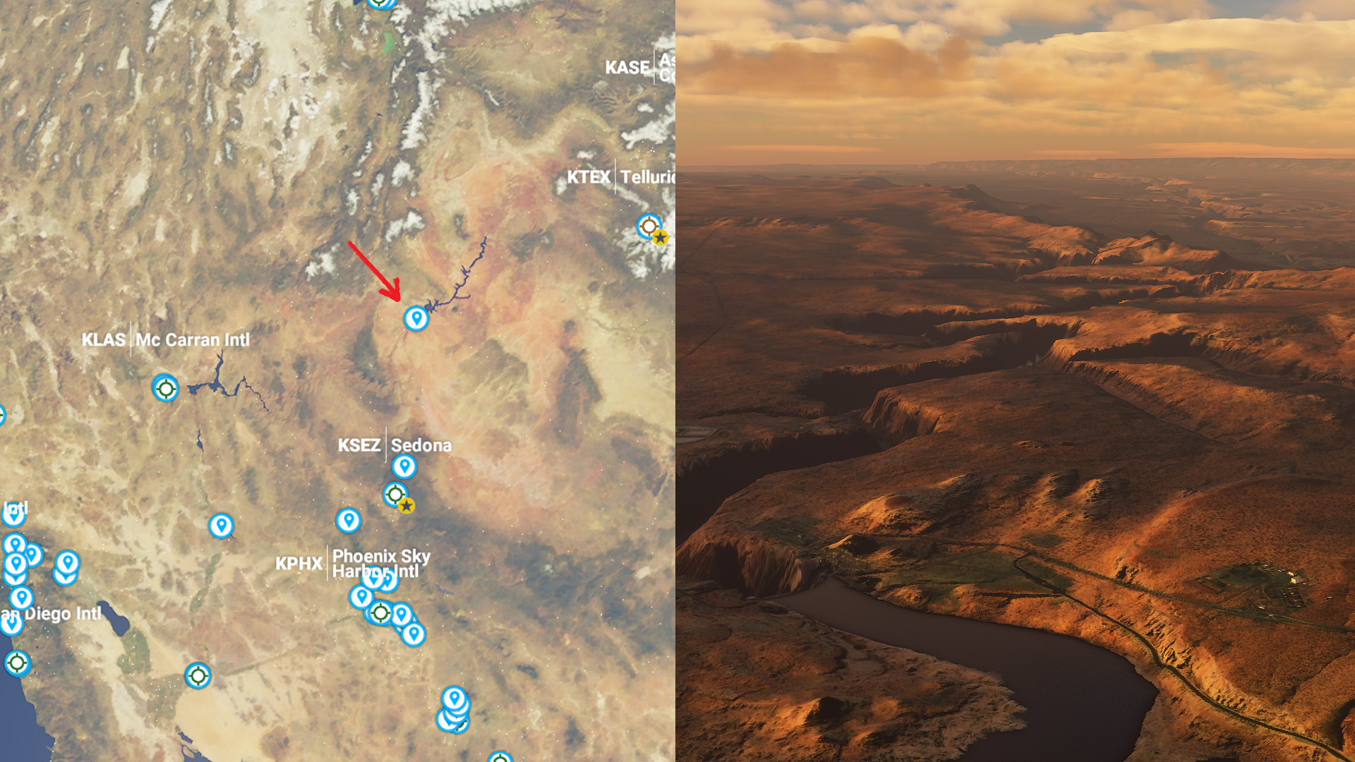
What is it? A gargantuan, rocky canyon in Arizona carved by the Colorado River. It's 277 miles long, 18 miles wide, and a mile deep, and it looks stunning in Microsoft Flight Simulator—especially at sunset.
How do I get there? Search for Sedona Airport (KSEZ) then look north and you'll see the jagged outline of the canyon on the map.
Lukla Airport

What is it? Nestled in the Himalayas, this airport is considered to be one of the, if not the, most dangerous in the world. Landing on the incredibly short runway will test your nerves, but the surrounding scenery is beautiful.
How do I get there? Search for Lukla Aiport (VNLK) on the world map.
Keep up to date with the most important stories and the best deals, as picked by the PC Gamer team.
Lofoten Islands
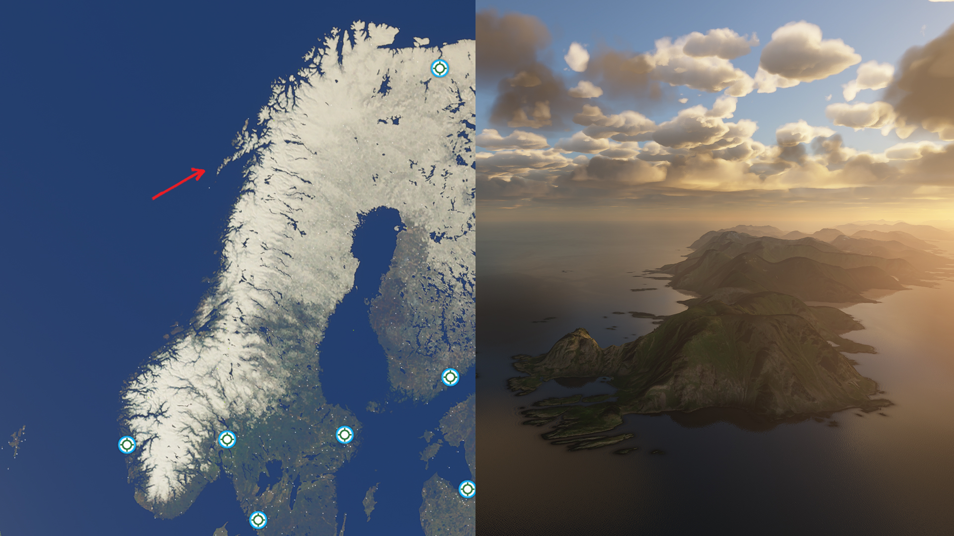
What is it? A dramatic, untouched archipelago in Norway, with mountains, bays, beaches, and small towns. When the clouds and lighting are just right, this is one of the prettiest places in Microsoft Flight Simulator.
How do I get there? You can find Lofoten on the scenic west coast of Norway. See the image above for the precise location.
Aogashima
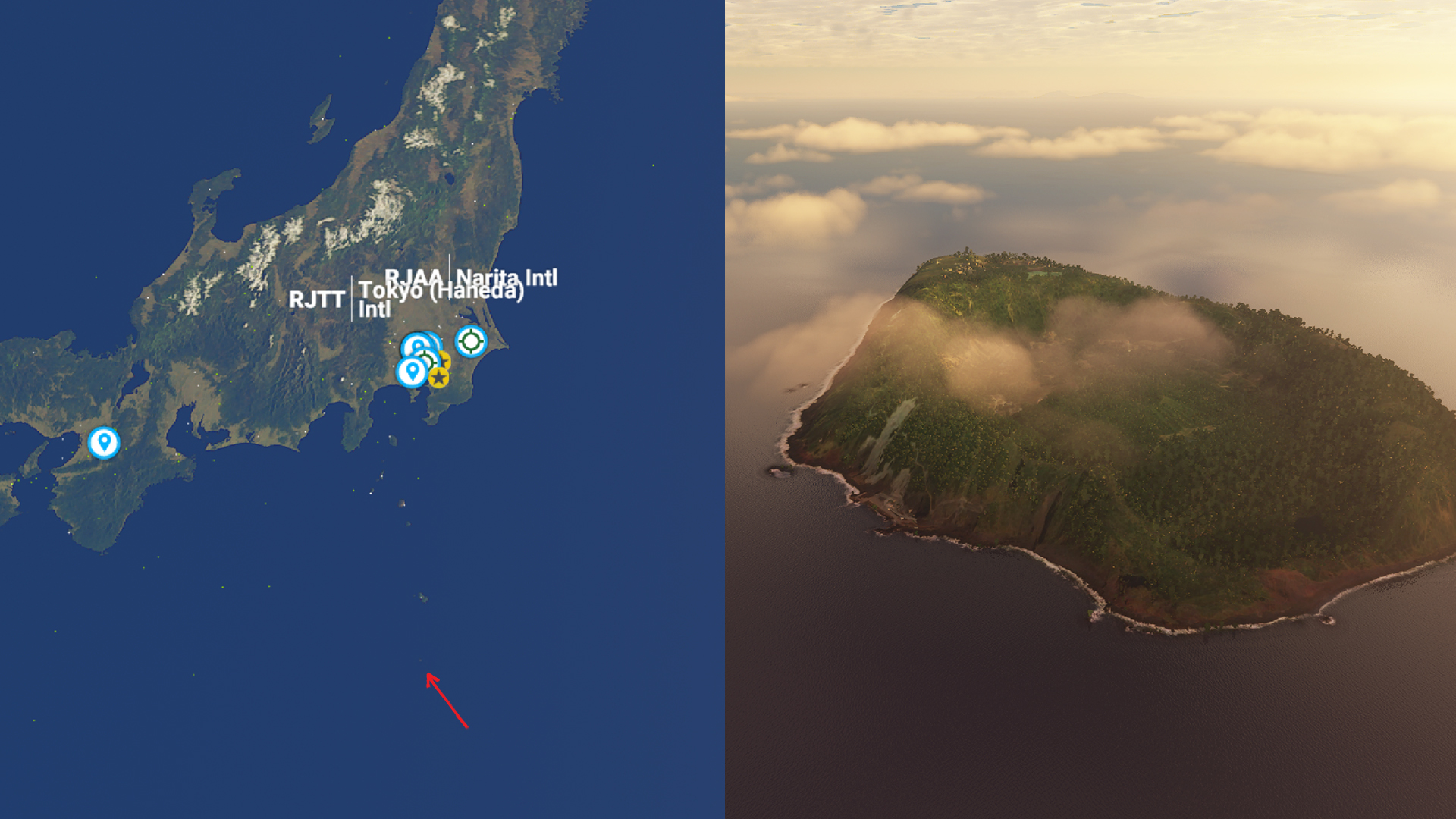
What is it? A volcanic Japanese island in the Philippine Sea that appears as an immense, forest-covered crater poking out of the water. A fascinating geographical oddity, and really cool to look at from the air.
How do I get there? Find Tokyo, then head south on the map. Aogashima is tiny, but the image above should help you locate it.
Hong Kong
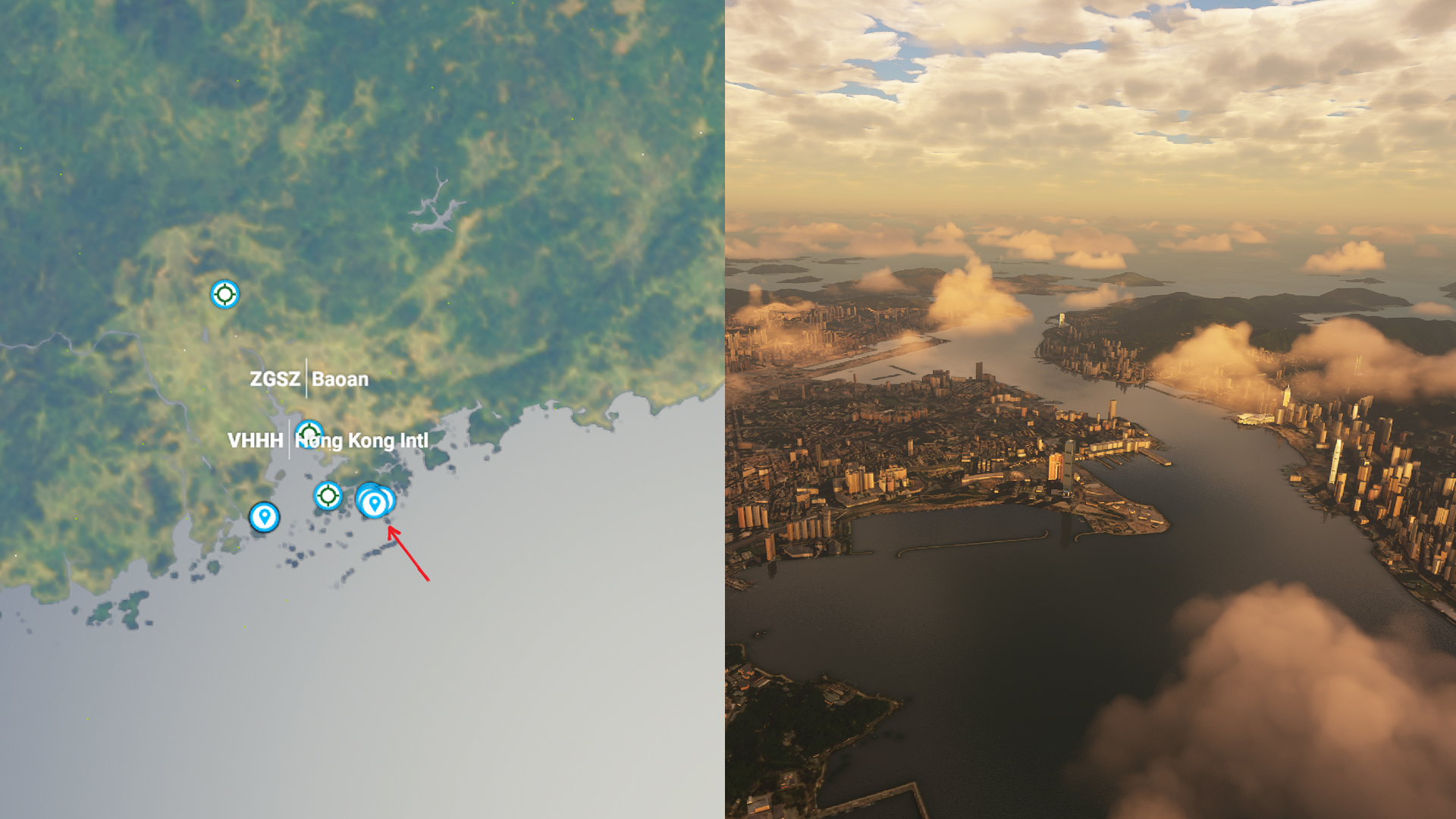
What is it? One of the most densely populated places in the world. Hong Kong looks incredible from the air, and you really get a sense of how tightly packed the city is. It looks just as impressive at night too.
How do I get there? Search for Hong Kong International Airport (VHHH) on the map and look east a little.
Giza
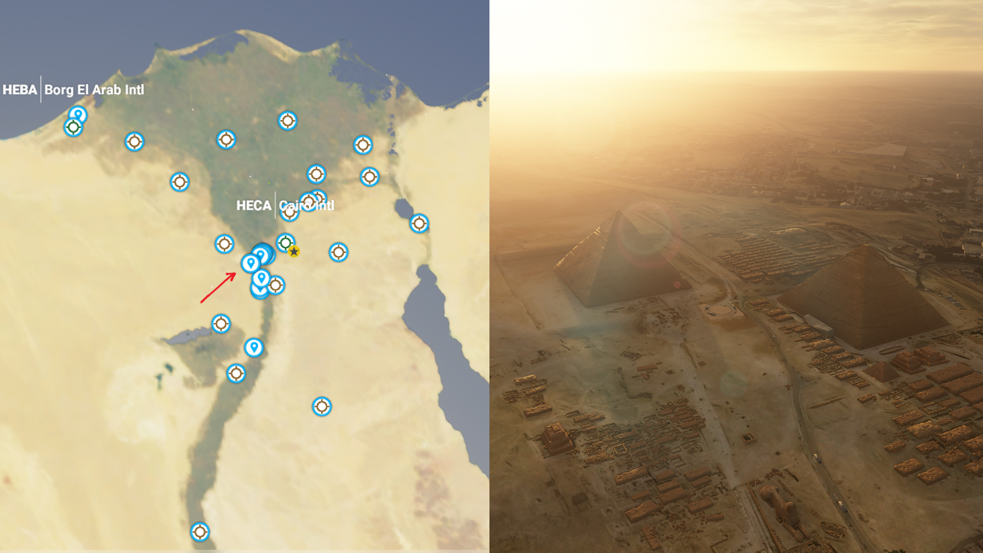
What is it? An Egyptian city located southwest of Cairo, on the banks of the Nile. The city is impressive, but the real reason to come here are the Ancient Egyptian ruins, including the Great Pyramid of Giza and the Sphinx.
How do I get there? Search for Cairo International Airport (HECA) then look south. The Great Pyramid is marked on the map.
Mount Fuji
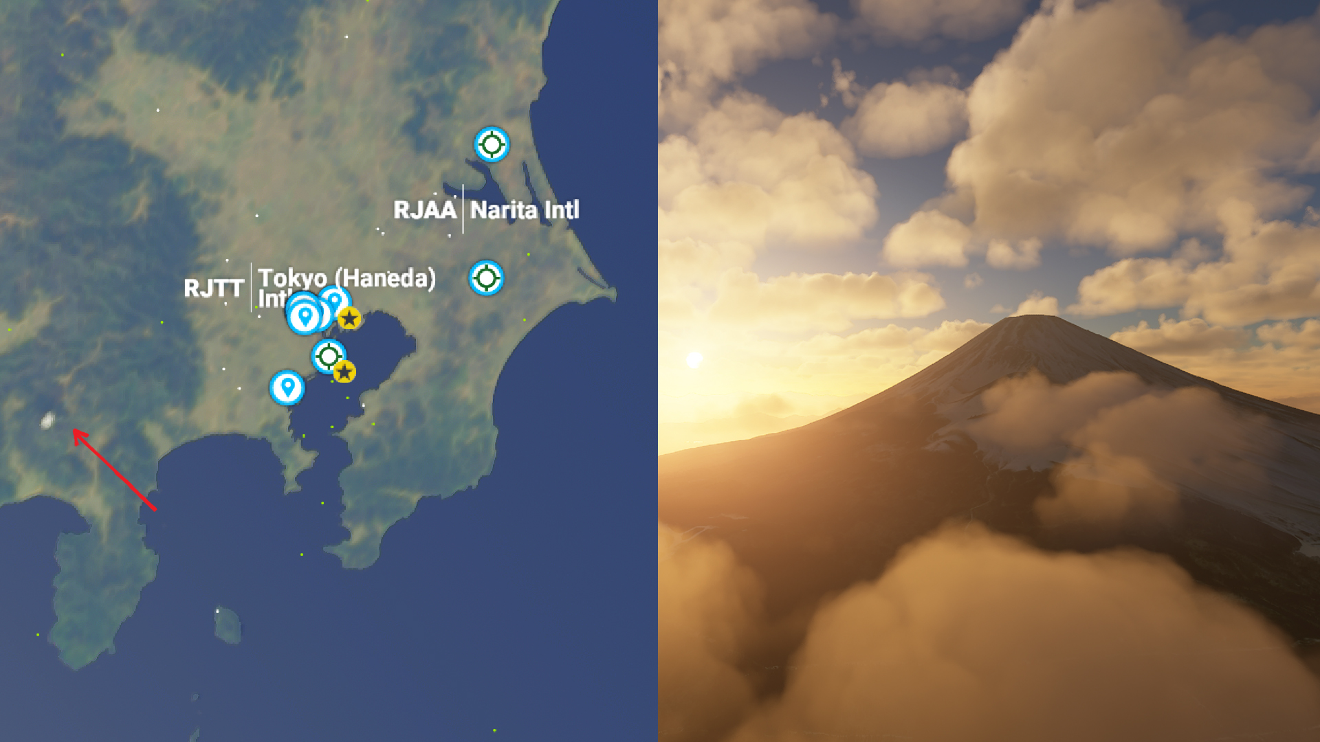
What is it? The highest mountain in Japan, and the subject of countless works of art. It's not just a mountain, it's a cultural icon, and Microsoft Flight Simulator nicely illustrates just how colossal it is.
How do I get there? Search for Tokyo's Narita International Airport (RJAA) then look southwest for the spot on the above image.
Nazca Lines
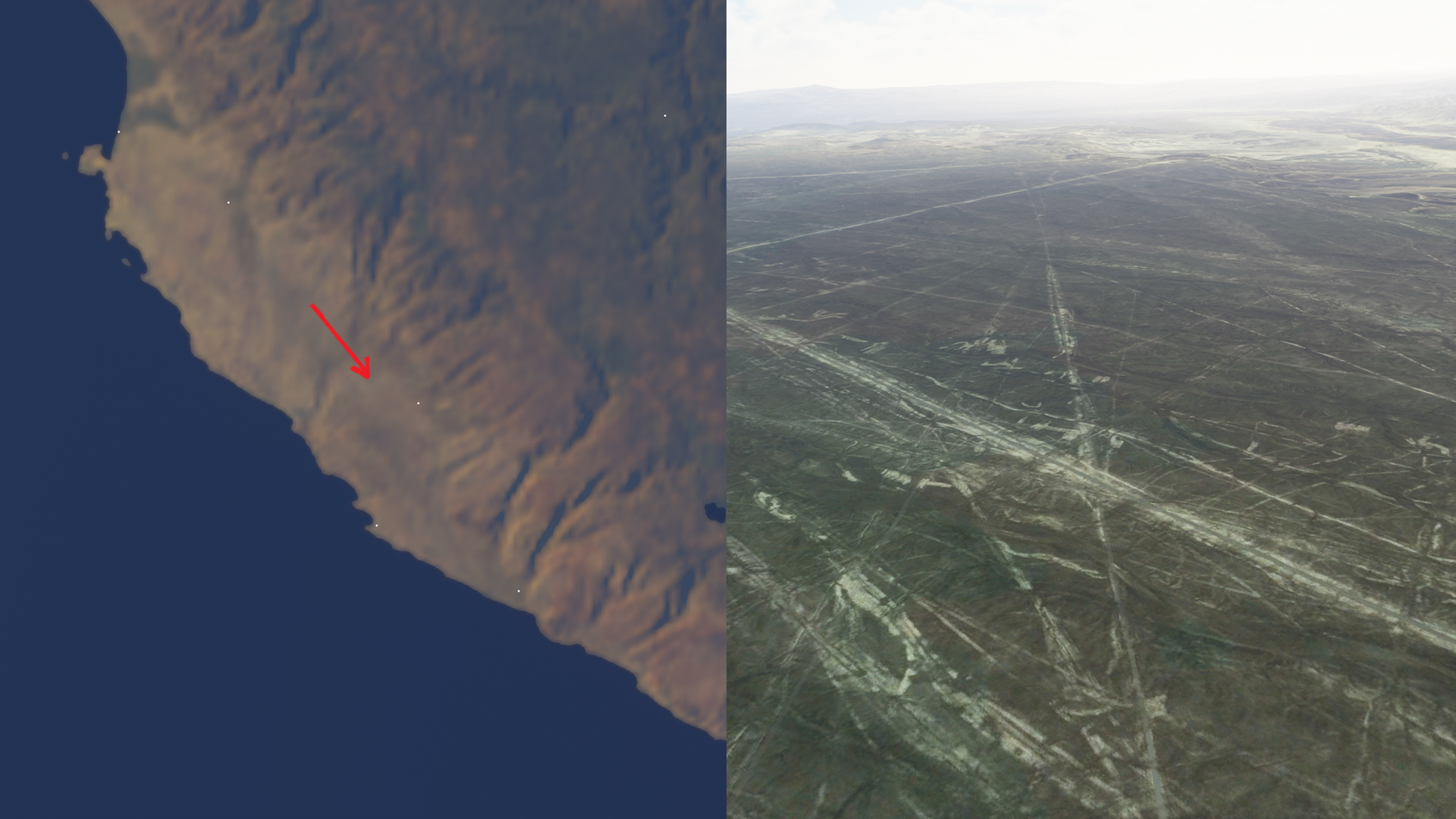
What is it? And now for something a bit different. Peru's Nazca Desert is home to massive, ancient geoglyphs and lines drawn in the sand. Why? Well, no one really knows, but there are some wild theories out there.
How do I get there? Search for Maria Reiche Neuman Airport (SPZA) on the map then head directly west. You can't miss the lines.
Jökulsárlón
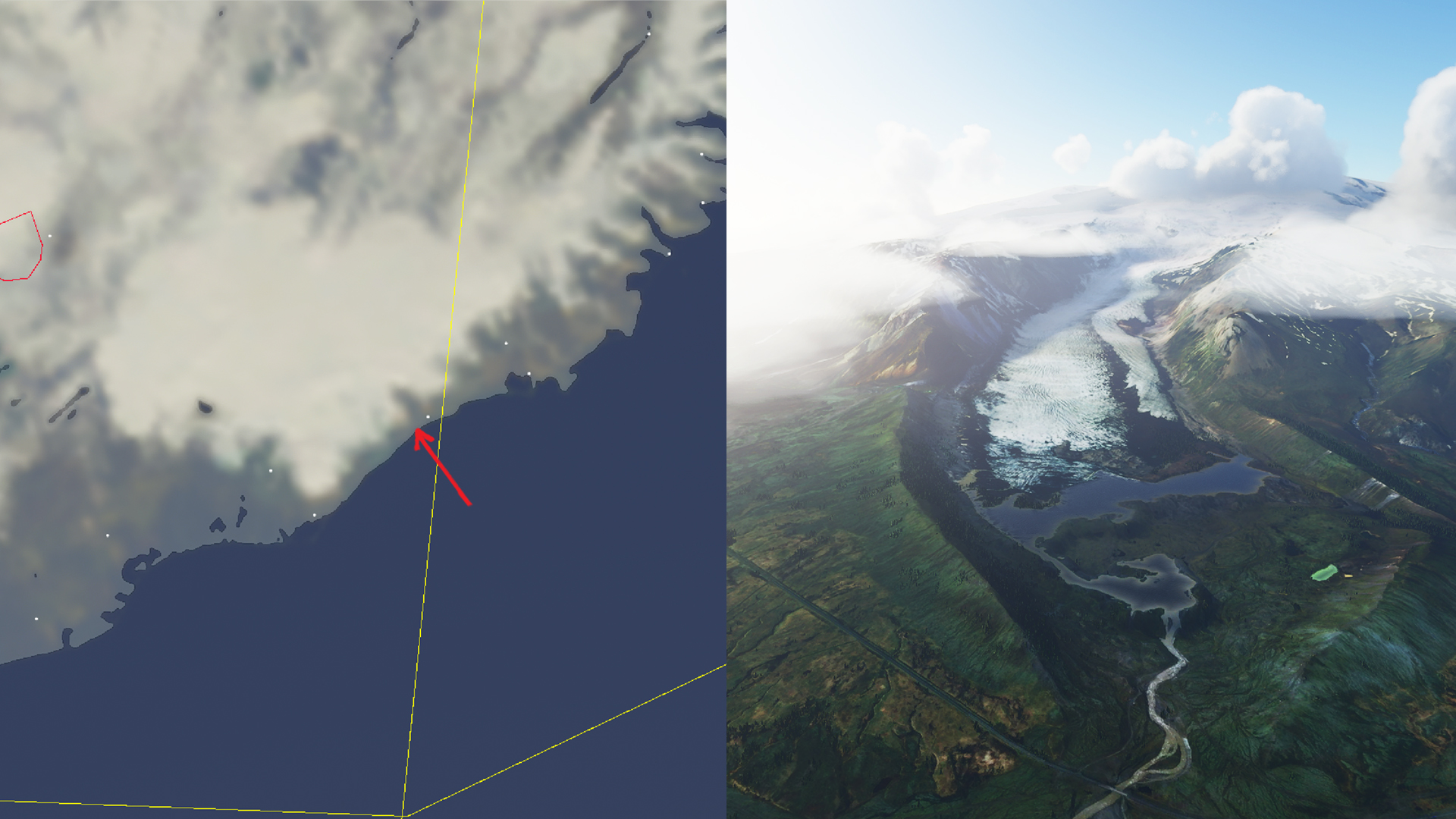
What is it? A dramatic glacial lake on the frozen south coast of Iceland. One of the most beautiful places on the planet, fed by the nearby Breiðamerkurjökull glacier, which looks absolutely enormous from the air.
How do I get there? There are no airports nearby, so just find the south coast of Iceland on the map and reference the image above.
Cliffs of Moher
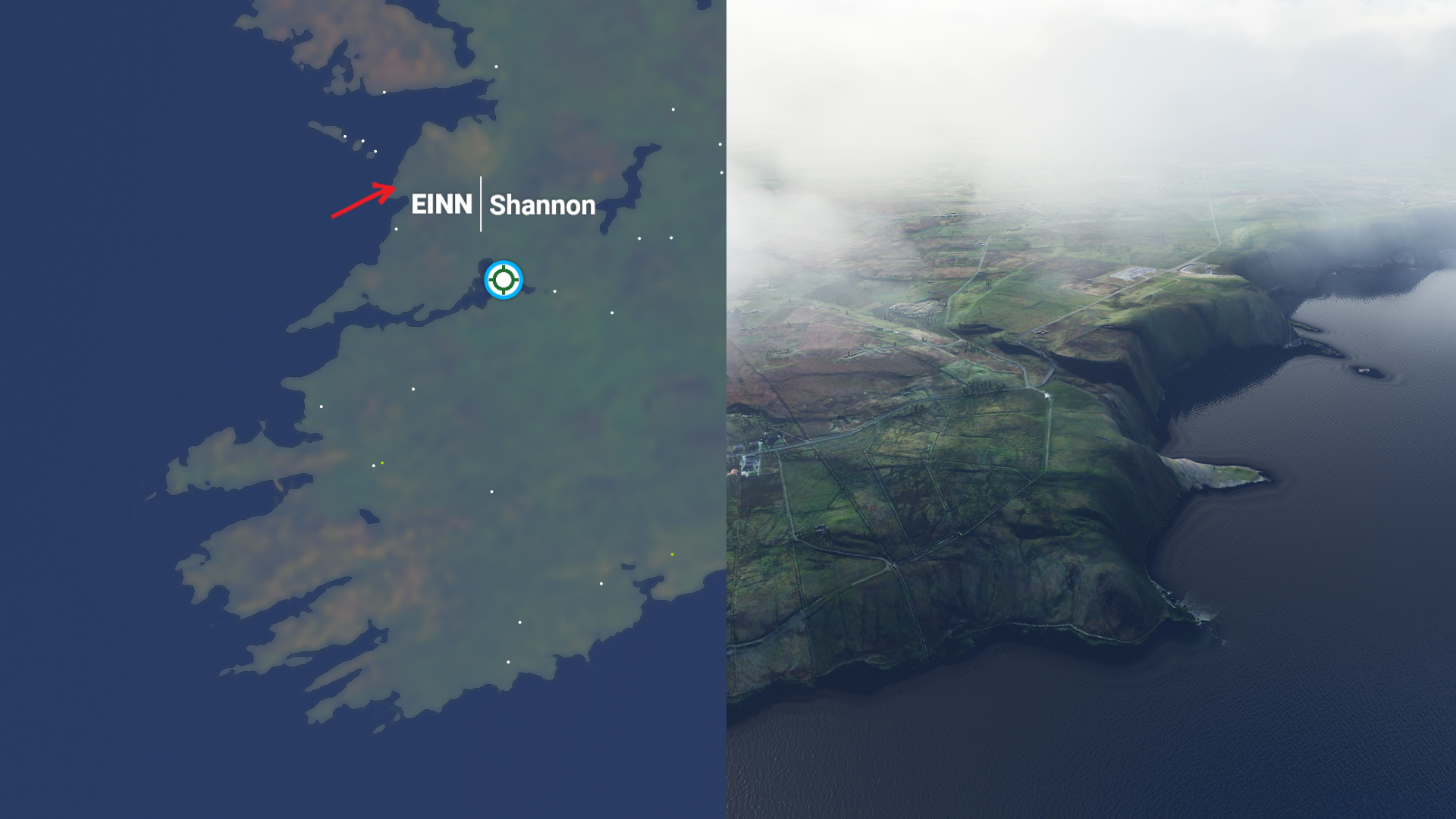
What is it? Ireland has some of the most rugged, dramatic, and beautiful coastlines in the world, including these famous cliffs. Rising 400 feet out of the Atlantic Ocean, they provide an epic backdrop for a flight.
How do I get there? Search for Shannon Airport (EINN), head northwest, then find the location marked on the image above.
- Microsoft Flight Simulator 2020 controls: The full list
If it’s set in space, Andy will probably write about it. He loves sci-fi, adventure games, taking screenshots, Twin Peaks, weird sims, Alien: Isolation, and anything with a good story.


